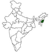
| Area |
: 22,327sq.km |
| Capital |
: Imphal |
| Districts |
: 9 |
| Language |
: Manipuri |
| Population |
: 2,570,390 (2011 census) |
| Literacy |
: 79.21% (2011 census) |
| State Bird |
: Nongin |
| State Animal |
: Sangai |
| State Flower |
: Uningthou |
| State Tree |
: Siroi Lily |
|
 |
|
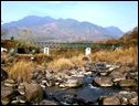
| Known as the 'Jewel of India', as it lies against deep
within a lush green corner of North East India, Manipur is a shining pearl
in the Himalayan system. Surrounded by blue hills with an oval shaped valley
at the centre, Manipur is bounded by Nagaland in the north, Mizoram in the
south, upper Myanmar in the east and Cachar district of Assam in the west.
The valley portion of the state is surrounded by hill ranges from all sides.
Manipur had been a Union Territory from 1956 and became a full-fledged state
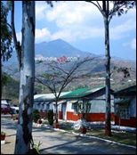
from 1972. Main Tourist places include War Cemetery, Saheed Minar, Manipur
Zoological Garden, Shri Shri Govindajee Temple etc. |
|
|
|
| Bishnupur |
| Chandel |
| Churachandpur |
| Imphal |
| Senapati |
| Tamenglong |
|
 |
The climate of Manipur is typically monsoonal
in character, with 'hot' rainy and cold weather
seasons. The months of March-April and May are
maximum heat. |
|
|
|
 |
|
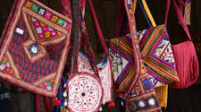
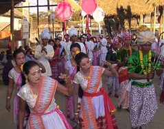
| Colourful Manipur |
| |
Manipur is the
centre of many religious and cultural traditions.
Read
More |
|
|
 |
|
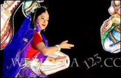
| Time to Enjoy.... |
| |
Manipur has a lively
tradition of song, dance, music and theatre.
Read
More |
| |
|
|
|
|