| Rivers and Water Ways
|
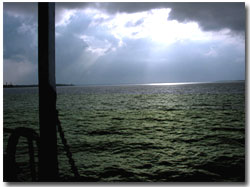
Courtesy for Picture
Prakash Saha
Kolkata |
The hilly region in the north comprising the district of Darjeeling is
cut through by deep gorges ofthe Teesta which flows from north to south
between mountainous banks rising two to three kilometres above the stream.
The Teesta on debouching into the plains south of Darjeeling at Sevoke,
flows in a mighty stream on straight line towards the south east until
it pours its waters into the Brahamaputra in Bangladesh. Other rivers,
smaller than the Teesta, rising in the Himalayas are Jaldhaka, the Torsha,
the Sankosh and the Raidak. Of these the Torsha is the most turbulent.
These rivers, carrying the back of the monsoon waters of the huge catchment
area of the Himalayas. During the dry reason they are navigable in the
plains below. The Mahananda rises from springs in the Dow Hills forest,
below Darjeeling town falls in the spectacular cascade named Pagla-Jhora
in to the sloping plains of southern Darjeeling district and fed by three
other similar rivers the Mahanadi, the Balason, and the Machi runs a zig-zag
course through Maldah district into the Padma in Bangladesh.
The central region is watered by the Mahananda as well
as such rivers arising in the plains as the Tangan, the Punarbhava
and the Atrai the former two combine their streams and flow into the Mahananda
and the Atrai flows into the Padma in Bangladesh. The southern region
is served by two river systems. One for plateau and the plains west of
the Gangetic delta and the other for the Gangetic delta itself. In the
former area, a number of rivers originating in the western plateau flow
down in a south easterly direction and join the Bhagirathi, the main westerly
channel of the Ganga moving down to the estuary of the Bay of Bengal.
Of these the north most is the Mayurakshi, which is fed by tributaries
Brahmani, Dwaraka, Bakreswar and Kopai. A little to the south the river
Ajay rising in the hills of Bihar, flows down the plateau fringe, marking
the boundary between Bankura nd Birbhum districts and joins the Bhagirathi
at Katwa. Three other small streams Khari, Banka and Behula were
one distributaries of Damodar, but are now meandering streams. The
biggest river of the plateau fringe, the Damodar, also rising in
the Bihar hills runs down in an easterly course until it takes a turn
to the south and flows into the Hooghly river. Hooghly river is called
as 'River of Sorrow'.
Further south is the Rupanarayan made up of two streams,
Dwarakeswar and Silai or Silabati. It joins the Hooghly near the estuary
at Haldia and its impressive width up to Kolaghat is due to the tidal
action on estuary. Still farther south are the Kansabati or Kasai and
the Subarnarekha, the latter rising in the Orissa hills and striking
the boundary between the states of Orissa and West Bengal.
In the remainder of the southern region, the main
channel of Ganga called Padma runs into Bangladesh where it joins to Brahmaputra
and the two rivers runs into one of the broadest estuaries of the world
and later meets Bay of Bengal below Noakhali in Bangladesh. The main body
of the Ganga waters being carried by the Padma. The main channel with
in a West Bengal is the Bhagirathi named in its lower reaches the Hooghly
river by the British taking off at the head of Murshidabad district, the
Bhagirathi flows southwards into a sea past the port city of Calcutta.
Near the Sea-mouth it is joined by the Rupmarayan at Haldia. The other
main channels the Bhairah and the Jalangai were mighty waterways
on account of changes in the land level due to seismic factors and the
deposition of heavy quantities of salt the Bhagirathi has been reduced
to a spill channel. The silting of the main channel river itself has assumed
such alarming proportions that steamship navigation up to the Port of
Calcutta has been seriously hampered by rise and spread of Sand banks.
An effort have to resuscitate its flow has been made in the shape of the
Farakka Barrage project which has completed in 1974.
The channels near the bay mouth are broad and comparatively
free from silt deposits. Tidal bores coming up from the sea on full-moon
days during late monsoon and in autumn sometimes rise to a height of over
six metres at the estuary, to about three metres in-land at Calcutta.
The other main channels in tidal basin are the
Manganga or Baratola, the Saptamukhi, the Thakuran, the Malta, the Gaushaba
and the Raimangal which skirts the boundary between West Bengal and Bangladesh
in the extreme south. All the channels are safe and pleasant during fair
weather months for navigation by country boat and streamers, affording
as they do a unique view of the majestic Sunderbans. |