|
|
Monday, May 4, 2026
|
|


|
|||
| Land
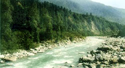
Himachal Pradesh The state is located in altitudes ranging from 450 meters to 6500 meters above sea level. It is veiled from the plains by the Shivalik range of mountains. (Shivalik literally means the tresses of Lord Shiva). There is a general increase in elevation from west to east and from south to north. The physiographic divisions from south to north are (1) The outer Himalayas or the Shivaliks (2) The lesser Himalayas or the central zone (3) The great Himalayan and Zaskar or the northern zone. The Shivaliks consist of lower hills (about 600mtrs above sea level ). These hills are composed of highly unconsolidated deposits which causes a high rate of erosion and deforestation. The lesser Himalayas are marked by a gradual elevation towards the Dhauladhar and the Pir Panjal ranges. The rise is more abrupt in the Shimla hills, to the south of which is the high peak of church- Chandni (3647mtrs). North of river Sutlej, the rise is gradual.
The great Himalayan range (5000 - 6000 meters) runs along the eastern boundary and is cut across by the Sutlej. Some of the famous passes in this range are Kangla (5248mtrs), Bara Lacha(4512mtrs), Parang (5548mtrs) and Pin Parbati (4802mtrs).
The Zaskar range is the eastern most range and separates Kinnaur and Spiti from Tibet. It has peaks rising over 6500mtrs, Shilla (7026mtrs) and Riwo Phargyul (6791mtrs) are the highest among its peaks. There are many glaciers or Shigri (local name) over the Zaskar and the great Himalayan ranges. Himachal has rich flora. Forests cover about 38% of the area. Several varieties of vegetation from the Himalayan meadows and high altitude birch and down to the tropical shrub and bamboo forests of the low foot hills are found here. It has a variety of wild life too. Himachal has 49 cities and towns. The smallest town is Naina Devi and the largest is Shimla with a population of about 6,17,404. Urban population is only 7.5% of the total population. Most of the people live in rural habitations varying in size from isolated hamlets to conglomerated settlements. |
|||
|
||||||||||||||||||||||||
|
||||||||||||||||||||||||
Related Links |
| ▪ Classifieds |
| ▪ Education |
| ▪ Yellowpages |
| ▪ Photo Gallery |
| Last Updated on : 20 July 2018 |

 ,
spread over 55,673 sq.km. is bordered by Jammu and Kashmir on north, Punjab
on west and south-west, Haryana on south Uttaranchal on south -east and
by Tibet on the east. It is a mountainous region, known for the natural
beauty of its forests, rivers, valleys, hills and dales and is rich in
natural resources.
,
spread over 55,673 sq.km. is bordered by Jammu and Kashmir on north, Punjab
on west and south-west, Haryana on south Uttaranchal on south -east and
by Tibet on the east. It is a mountainous region, known for the natural
beauty of its forests, rivers, valleys, hills and dales and is rich in
natural resources.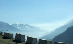 The Kangra valley is a longitudinal trough at the foot of theDhauladhar
range. Dhauladhar which means the 'White Peak' has a mean elevation of
about 4550 meters. It has an abrupt rise of 3600mtrs above the Kangra
valley. The largest of the lesser Himalayan ranges, the Pir Panjal, branches
off from the greater Himalayan range near the bank of the river Sutlej.
Numerous glaciers exist and several passes lie across Pir Panjal. The
Rohtang Pass (4800mtrs) is one of them
The Kangra valley is a longitudinal trough at the foot of theDhauladhar
range. Dhauladhar which means the 'White Peak' has a mean elevation of
about 4550 meters. It has an abrupt rise of 3600mtrs above the Kangra
valley. The largest of the lesser Himalayan ranges, the Pir Panjal, branches
off from the greater Himalayan range near the bank of the river Sutlej.
Numerous glaciers exist and several passes lie across Pir Panjal. The
Rohtang Pass (4800mtrs) is one of them