| Area |
: 83,743 sq .km |
| Capital |
: Itanagar |
| Districts |
: 15 |
| Language |
: Monpa, Apatani, Hill, Miri, etc |
| Population |
: 1,383,727(2011census) |
| Literacy |
: 65.38% (2011census) |
| State Bird |
: Horn
Bill |
| State Animal |
: Mithun |
| State Flower |
: Fox tail Orchid |
| State Tree |
: Hollong |
|
 |
|
| |
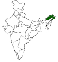
Arunachal Pradesh is a thinly populated hilly tract lying on the north-east
extremity of India comprising roughly 83,573 square kilometers. The
Pradesh is known to be rich in flora, fauna, power and mineral
potential. Previously this region was known as the North East Frontier
Agency (NEFA) and constituted a part of the state of Assam. Arunachal
Pradesh became an independent state on 20th February 1987. It is bounded
by independent countries on the three sides and by Assam and Nagaland
in the south. The long international border comprises of Bhutan on its
west (160 km), the Tibet region of China on its northern and north east
border (1080 km) and Myanmar (formerly Burma (440km) on the eastern
border. |
|
|
| |
| Tawang |
| Lohit |
| West Kamang |
| East Kamang |
| Papum-Pare |
| Upper Siang |
 |
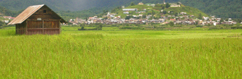
Arunachal Pradesh is a small state, tucked away in
the south west corner of India. It represents only
1.18 percent of the total area of India but has 3.34%
of the total population of the country. |
|
|
|
|
|
|
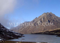
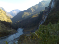
| Arunachal Pradesh, the land with its incredible
natural beauty is a small coastline state
of India |
|
|
|
 |
|
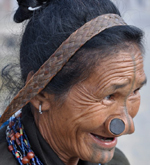
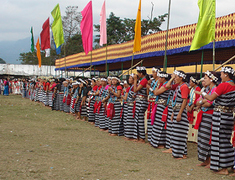
| Colourful Arunachal Pradesh |
|
Arunachal Pradesh can be termed as the land of fairs and Festivals.... |
|
|
|
|
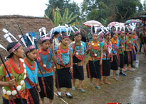 |
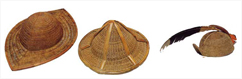
| Time to Enjoy.... Arunachal Pradesh has a rich
tradition of folk music. Even villages have been
named after classical ragas. In Dadri tehsil,
several villages have names related to well known
ragas. |
|
|
| | |
|