Thursday, April 18, 2024
Daman & Diu
daman

Area

: 112 sq.km

Capital

: Daman

Languages

: Gujarati and Marathi

Districts

: 2

Population

: 242,911 (2011 Census)

Literacy      

: 87.07

Daman and Diu map

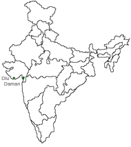
Daman and Diu is the second smallest union territory of India. Lakshadweep being the smallest in terms of area as well as population. Daman and Diu are actually two 
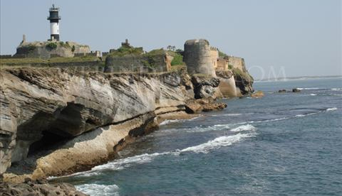
parts, both on the sea side and both enclosed by Gujarat. Daman is near Surat in the South of Gujarat  while Diu is near Junagadh in the Saurashtra Peninsula  of Gujarat. Daman is a small part in the Gulf of Khambhat 
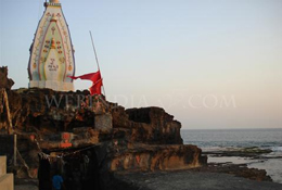
(Cambay) while Diu is an island joined to the mainland of Gujarat by a 
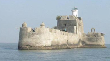
creek. During the early period, Daman and Diu were part of Goa. It was only in 1987, when Goa become a full fledged state, that Daman and Diu was separated from Goa. These three different land blocks on the west coast of India had come to form 1961.  read more

Nani Daman Nagoa Beach
Fort of Moti Daman St. Paul's Church
Fort of Nani Daman Hoka Trees
Gangeshwar Temple    
 
During the early period, Daman and Diu were part of Goa.
History Land Economy
diu
Daman lies 193kms north of Bombay on the coast of the southern edge of Gujarat just north of Dadra and Nagar Haveli.
About Daman and Diu
Tourist Information Centres
How to Reach
festival
Colourful Daman and Diu
Gangaji fair is held every year in the village Dabhel, near the Somnatha Mahadev temple..
Fairs and Festivals
Festival Calendar