|
|
Sunday, April 5, 2026
|
|


|
|||
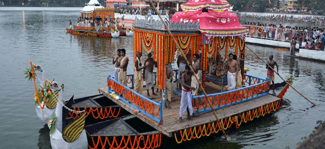
Odisha (Orissa) extends from 17o 49'N to 22o 34'N latitude and from 81o 29'E to 87o 29'E longitude on the eastern coast of India. It has an area about 155,707 Sq Km. according to the Census of India 1991. It is bounded by West Bengal in north-east, Bihar in the north, Madhya Pradesh in the west, Andhra Pradesh in the south and the Bay of Bengal in the east. Odisha (Orissa) was separated from Bihar and came into existence on 1 April 1936. The capital was established at the historic city of Cuttack, located at the apex of the Mahanadi delta. In 1956, it shifted to Bhubaneswar, a planned modern town of the post-independence period. Physiographically, Odisha (Orissa) can be divided into three broad regions 1) The Coastal plains, (2) The Middle mountainous country (3) The Plateaus and rolling up lands. The coastal plains of Odisha (Orissa) stretch on the eastern coast of India from the Subarnarekha in the north-east to the Rushikulya in the south-west. This fertile region is known as the 'rice bowl' of Odisha (Orissa). This is narrow in the north, widest in the middle, narrowest in the Chilika coast and broad in the south. The coastal plain is a gift of six major rivers. The formation of the coastal plains depends on the rivers and their catchment's area. The rivers are: From north to the south, the Subarnarekha, the Burhabalanga, the Baitarani, the Brahmani, the Mahanadi and the Rushikulya. Most of the rivers have failed to develop true deltaic characteristics because of the strong off shore current which moves from Chennai to the Andhra coast and passes through Odisha (Orissa) coast. According to the location, the coastal plain can be divided into three sub regions a) The north coastal plains - the deltas of the Subarnarekha and the Burhabalanga upto the river Baitarani b) The middle coastal plains - the combined deltas of the Baitarani, the Brahmani and Mahanadi c) The southern coastal plains - the Rukshikulya plains, it can be divided into three zones parallel to the shoreline i) The salt track along the coast. ii) The arable tract or rice country in the middle iii) The sub-montane tract to the west i) The Salt tract: The salt tract is a narrow belt which stretches just beyond the shore line for about 4.8 to 9.6 Km in land. In many places it is impregnated with salt and is completely deprived of agriculture. The innumerable sluggish and blackish streams make the area difficult to traverse. In the Mahanadi delta, this salt tract is covered with tidal forest known as the "Little Sunderbans", off Paradeep-Dhamra coast. In the Devi-Daya sector, Casuarina forests and plantations are found. The forest belt all along the coast merges with a narrow belt of pasture.
ii) The Arable tract:
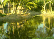
iii) The Sub montane tract: This is the meeting zone of the arable tract and the spurs of the Eastern Ghats. It is termed as the 'zone of transition'. Soil erosion is rampant here. Under this predominating red soil, blocks of laterite are buried and at times they crop up to the surface, turning the area barren and desolate. In this zone low level laterites are formed. But patches of fertile area are not uncommon having rich vegetation. The natural vegetation varies from prickly thorns and stunted shrubs to Sal forests. The absence of a coastal forest belt is most striking. This is because of the lack of a marshy strip due to higher orography. |
|||
|
||||||||||||||||||||||||
|
||||||||||||||||||||||||
Related Links |
| ▪ Classifieds |
| ▪ Education |
| ▪ Yellowpages |
| ▪ Photo Gallery |
| Last Updated on : 21 February 2026 |

 The
grass belt merges into the vast plains. The endless stretches of rice lands
is the fundamental characteristic. Most of these places are occupied by village
sites so as to be free from the annual inundation. The rivers have formed levees
and during high floods they inundate vast areas, causing grave danger to human
lives, cattle population and agriculture parts of this arable tract are protected
from floods and are irrigated by gravity.
The
grass belt merges into the vast plains. The endless stretches of rice lands
is the fundamental characteristic. Most of these places are occupied by village
sites so as to be free from the annual inundation. The rivers have formed levees
and during high floods they inundate vast areas, causing grave danger to human
lives, cattle population and agriculture parts of this arable tract are protected
from floods and are irrigated by gravity.