Thursday, April 18, 2024
Tripura
Tripura
Area    : 10,492 sq.km
Capital : Agartala
Districts         : 8
Language : Bengali, Kakbarak & Manipuri  
Population : 3,673,917 (2011 census)
Literacy : 87.22% (2011 census)
State Bird : Green Imperial Pigeon
State Animal : Phayre's Langur
State Flower : Nageshwar
State Tree : Agar
Tripura map
 

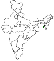
Tripura is the second smallest state in India. It was formally declared as Union Territory on November1st, 1957 and was elevated to the status of a full-fledged state on January 21,1972. The state lies approximately between latitude 22o56' and 24o32' north and longitude 91o10' and 92 21' east. It is bordered by Bangladesh on the west, south and north, by Assam on the north-east and by Mizoram on the east.
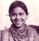
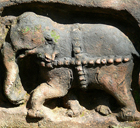
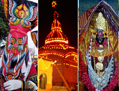
   dotdot

  Agartala
  Ujjayant Palace
  Neer Mahal
  Sipahijala
  College Till
  Debtamura
  Jampui Hill
about tripura

Tripura is a smallest hill state in North East India. It covers 10,500 sq km, and almost all the places are surrounded by Bangladesh.

History Land Economy
Classifieds District Map Govenment
Education Yellow Pages    
Tourism
Tripura is a smallest hill state in North East India.
About Tripura
Tourist Information Centres
How to Reach

Fairs & Festivals of TripuraColourful Tripura

The main features of festivals in Tripura is that, whether a festival is basically tribal or not, all people - tribal and non-tribal will join it in a joyous mood and be part and parcel of it.

Fairs and Festivals Festival Calendar