|
|
Friday, April 19, 2024
|
|


Jammu and Kashmir |
|
Capital | Climate | Provenance | Kashmir Valley | Ladakh | Population | Rivers |
|
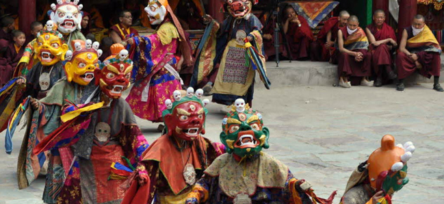
One of the largest states of the Indian union, Jammu and Kashmir covers an area of 222,236 sq km . This includes 78,114 sq km under illegal occupation of Pakistan, 5,180 sq km handed over by Pakistan to China, and 37,555 sq km under occupation of China. The state lies between 32o 17' to 36o 58' North latitude and 73o 26' to 80o 30' East longitude. From North to South, it extends over 640 km and from East to West 480 km. It occupies the North-West niche of India, bounded on the South by Himachal Pradesh and the Punjab, on the South West and West by Pakistan, on the North by Chinese Turkistan and a little of Russian Turkistan, and on the East by Chinese Tibet - thus strategically bordering the territories of three countries - Russia, China, and Pakistan.
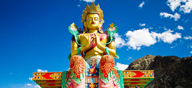
Population The population of the state, according to the 1981 census was 5,987,389 (3,164,660 males and 2,822,729 females) - this figure excludes the areas under the occupation of Pakistan and China. According to the projections made by the standing Committee of Experts on Population Projections , October 1989, the population of the state was 7,718,700. The 1991 census could not be held due to disturbances in the state. The density of population as given by this Committee is 76 persons per sq km. The decimal population growth rate for 1981-91 was given as 28.92% as against 29.69% for the period 1971-81. The religion wise break-up of the population as per the 1981 census showed that the Muslims constituted the predominant religious community of the state at 64.19%, Hindus came next at 32.24%, Sikhs 2.23%, Buddhists 1.16 %, Christians 0.14%, and others form the remaining part. Geographically, the Jammu and Kashmir state is divided into four zones. First, the mountainous and semi-mountainous plain commonly known as Kandi belt, the second, hills including Shiwalik ranges, the third, mountains of Kashmir valley, and Pir Panjal range and the fourth is Tibetan tract of Ladakh and Kargil. Kashmir Valley The valley of Kashmir is a unique, oval plain, approximately 134 km in length and 32 to 40 km in breadth, with an average height of 1,800 m above the sea level, and nested securely among the Pir- Panjal range of the Himalayas. The mountains which surround the valley are varied in form, height, and colour . To the east stands hoary-headed Harmukh (5,150 m), the formidable mountain guarding the valley of the Sindh. Further south is Mahadev and the lofty ranges of Gwasha Brari (5,425 m). The peak of Amarnath (5,280 m) also lies in this area. On the south-west is the Pir Panjal range with peaks 4,500 m high and to the north are ranges of the Karakorams and the Himalayas, dominated by the majestic Nanga Parbat (7,980 m), also called by the poetic name of Diyamir. Covered with snow all the year round and rising glistening white , it is the fifth highest mountain in the world. Latitude wise, Kashmir corresponds to Damascus in Syria, Fez in Morocco and South Carolina in the United States. The legend that the Kashmir valley was a vast lake, Satisar, in pre-historical times, corresponds with the results of geological observations. The sandstone rock at the western corner of the basin was most probably formed by volcanic action. The lake was drained by the deepening of the Baramulla gorge - the result of the slow process of erosion spread over geological years. Tradition has it that the drainer of the lake was Kashyap, after whom the valley was called Kashyap-mar, which, with the passage of time, became Kashmir . According to an interpretation, Kashmir is a prakrit compound with its components Kas meaning ' a channel ' and Mir, 'a mountain ' - the compound word adding to a 'a rock trough'. In the puranas, Kashmir is called gerek (hill) because of its overwhelming hilly features. The word Kashmir has been shortened by Kashmiris into Kashir . Kashmiris call their language Koshur or Kashur. The shape of the valley is that of an elliptical saucer. The floor of the vast valley is built of small consolidated lake beds and alluvial soils. Numerous plateaus, locally known as Karewas, stand up isolated in the middle of the valley . Rivers Kashmir is a land of lakes and rivers. The river Jhelum (ancient name , Vitasta - trasformed into Veth, in Kashmiri parlance) meanders through the valley in artistic Zigzags, which have furnished the motifs to the deft Kashmiri artisans. Nestled among hills in the north-east of the valley is the Wular (20 km by 8 km), the largest fresh-water lake in India. The Dal lake, well known for the Mughal gardens flanking it, in the vicinity of Srinagar, is about 6 km long and about 3 km broad. Other well-known lakes are the Manasbal (the deepest in Kashmir), the Kaunsar Nag (3,901.44 m) and the Gangabal and other mountain tarns, at an elevation of over 3,300 m. In the Lidder valley, there are huge glaciers like Kolahai which is about 8 km long and comes down as low as 3,300 m . The mountains and lakes are complemented by luxuriant orchards dotted with majestic chinar trees, providing so many breathtaking spectacles. Climate The Kashmir valley enjoys an enchanting climate for the major part of the year. A unique feature of the climate is the four clear-cut seasons - spring, summer, autumn, and winter. Till the end of May , the climate of Kashmir is comparable with that of Switzerland. In spring, the valley wears blankets of emerald green grass and is decked with flowers of various hues and fresh leaves - a phenomenon of rejuvenation from the rigors of a long winter. It is then the worlds' most wonderful of natural gardens. In summer, the sleepy blue mountains with snow-capped peaks, clear streams, cool bubbling springs, noisy torrents, beautiful lakes, shady chinar groves, silvery poplars, drooping willows and pine forests make Kashmir the ' play ground of Asia '. In autumn, the trees and forests turn into bronze and copper colours, and the foliage becomes a riot of golden yellow and green. In winter, the giant size trees wear a bare look when the landscape dons a mantle of snow. Capital Srinagar (the city of Saraswati - the goddess of learning) is an ancient city. Founded by Asoka (272-232 B.C), it was then called Pravarapura, after king Pravarsena. Srinagar was a great seat of learning in those days, throbbing with life and bristling with commerce. It was also called Shrinagri - the city of wealth and beauty. Situated tin the centre of the valley, Srinagar, the summer capital of the state, is the most populous city, covering an area of about 28.5 sq km. The river Jhelum, flanked by the Dal lake and intersected by canals, runs through the city and lends an idyllic charm to it. Hence, the city has been called the ' Venice of the East '. Anantnag (also called Islamabad) is another ancient town of Kashmir, about 64 km to the north of Srinagar. It is an exotic town full of springs, and streams run in every other compound. Some of these are sulphurous springs which have curative qualities. Other major towns are Baramulla and Sopore, both situated on the Jhelum after the river enters the Wular lake and emerges from it Agriculture Agriculture is the mainstay of the Jammu and Kashmir economy. Nearly 82% of the state's population living in rural areas is dependent on agriculture and allied activities. About 37% income of the Jammu and Kashmir state is from the agriculture sector. About 724,000 hectares of land are under cultivation and more areas are being brought under the high - yielding variety crops. Rice, wheat, barley, bajra and jowar and various fruits are grown here. Raising livestock is another source of income to the farmers. Jammu Province The strip of level land at the northernmost extremity of the plains of the Punjab which touches the low ridges of the hills and spreads over a large tract, constitutes what is called the ' region of the outer hills'. Varying in height from 60 m to 1,200 m above the sea level, these rugged hills run parallel to one another, enclosing small, narrow valleys. The province of Jammu lies between the 'outer hills ' region bounding the valley of Kashmir in the south, and the hilly tract extending to the plains of the Punjab. The river Ravi flows in the east of this region and the river Jhelum in the west. The Chenab issues forth from the mountain into the plains near the town of Akhnur and flows through the Jammu district before entering the plains of the Punjab. The 'outer hills ' region consists of Kdhampur, Ramnagar, and Rampur. The rugged hills give way in the north and north-east to the outer hills of the Shiwaliks, 1,200 m to 3,600 m above the sea level. There is a continuous rise in elevation to what are conveniently called the 'middle hills' or the middle Himalayas. In this region lie the districts of Batote, Bhadarwah, Kishtwar, Doda, and Ramban. Jammu city, the winter capital of the state, stands on the spurs of a rugged hill overlooking the plains and the river Tawi. The city is about 300 m above the sea level and about 4 km wide. According to 1991 census, the city had a population of 1,207,996. The prominent features of the city are its temples, whose pointed spires can be seen from afar. Other towns in this plain, and to the east of the Chenab are Basoli, Ramkot, Ramnagr, and Samba and to the west of Chenab, Akhnur and Bhimber. The Jammu district occupies an area of 26,089.4 sq km. The relief features of the province provide interesting climatic as well as floral phenomena. There is a sort of wind divide starting from poonch and extending to the southern edge of the Pir Panjal. The area has summer precipitation . As in the plains, the south-west monsoons cause rain in the 'outer plains' area and the 'outer hills' region. As the altitude rises towards the 'middle mountains' area of Batote, Bhadarwah, Kishtwar, Padar, and Banihal, the summer rainfall averages 45 inches (113 cm). Riasi and poonch get more than 60 inches (150 cm) of rainfall annually. The 'outer plains' areas of Ramnagar, Ramkot, Samba, Basoli, Akhnur, and Bhimber experience the extremes of tropical heat. The average annual rainfall in Jammu district is nearly 45 inches (113 cm). The hot season lasts from April to June, followed by the rainy season from July to September. Winter lasts from October to March. There is a luxurious growth of vegetation all over the 'outer hill' and the 'middle mountains' areas which is mostly of tropical variety. The upper reaches of the mountains are thickly covered with coniferous forests. The lower regions have forests of silver fir, deodar, spruce, oak, and pine. The best varieties of pine and deodar are found in the dense forests of Kishtwar and Bhadarwah. The 'plain area ' bounds in cactus varieties of bushes and trees. The main crops in the Jammu valley are maize, rice, millet, barley, and wheat. Jammu province is rich in minerals coal, bauxite, copper, zinc, and lead are abundant. Sapphire mines are located at higher elevations in the Papar valley. Semi - precious stones like beryl and aquamarine and crystals like quartz and felopar are also found in the region. Riasi has coal, gem stones, gypsum, clay, copper, bauxite, and iron ore. Though little known, the tableland of Kishtwar is flanked by the high and steep mountains of the 'middle mountains' region, the highest point being 4,089 km above sea level. It has an area of 7,311 sq km. Kistwar is famous for mines of sapphire and rubies. The climate is pleasant and bracing in summer and cold in winter. Kishtwar and Bhadarwah, with heavily forested mountains, are regular haunts of hunters. They can hunt panthers, black and red bear, wild goat, ibex, musk deer, wolf, barasingha, pig, Himalayan chamois, leopard, etc. In the river beds, swamps, and low forests, a variety of winged game - duck, goose, chakor, monal pheasant, partridge, and snipe, are found in preserves for sportsmen. Saffron is grown here. Black cumin, medicinal herbs, like banafsha, kalizaban, dhoop, musk, sala, artemesia , belladonna are grown in the region. Narcotic herbs are also found. Blankets and leather goods of the region are famous . Ladakh Beyond the valley of Kashmir , the inner Himalayas rising in the north and east contain the frontier region of the state . The territory comprises the three geographical divisions of Ladakh, Baltistan, and Dardistan. Out of the total area of the state of 138,992.1 sq km, the district of Ladakh (97,782 sq km ) covers 70.4% of the total area . The province of Ladakh touches the Chinese border on the north, merges into Tibet in the east and is contained along the south by the extension of the great Himalayan ranger . The Karakoram range of mountain lies in the north Ladakh. The second highest peak in the world, K2, crowns one of its many tall mountains. The Karakoram pass (5,517.64 m) is situated towards the north-east of Karakoram, in an area where China, Tibet, and Ladakh meet. This pass facilitates a direct route from India to China. Until some years ago, Ladakh used to be the gateway to Tibet, connecting India with Tibet and east Turkistan. As such, it was an important trade centre, also being the meeting point of the Tibetan, Indian, Chinese, and Islamic cultures and traditions. Leh, the capital (3,521 m above the sea level) is a fascinating town built on a hillside and surrounded by rocky hills. It was once the commercial nerve centre of Asia, just as Hong Kong is of the Far east. Traders thronged Leh from Turkey, Arab countries, Iran, and Afghanistan. Leh town is full of orchards, groves, gardens, and monasteries and is crowded with people. Poplars and Willows are aplenty. Apples, apricots, and giant-size melons are grown in these orchards. Ladakh is a mountainous terrain between the Himalayas and the Kuenlum mountains. One of the highest habitations in the world, Ladakh has an elevation ranging between 2,400 m and 4,500 m above the sea level. The average height of its mountain is between 5000 and 7000 m. Its valleys, about 500 sq km in area, lie along the headwaters of the Indus, the Sutlej, and the Chenab rivers. The Indus, having originated hundreds of kilometres further east from near the Kailash mountain and the Mansarovar lake in Tibet, flows in an almost straight line from north-west to the south-east of Ladakh. The river enters the region of Skardu in Baltistan. An interesting spectacle in Ladakh is represented by hot springs and geysers roaring and throwing steaming hot water up to a height of 150 m and projecting fantastic rainbow colours. These fountains of water represent phenomenon in winter when the boiling water comes down in the shape of ice blocks with the impact of chilly winds, and form mounds next to the geysers. In the north-east of Leh, at the town of Nyoma, lies an unusual terrain, where the colour of the soil and rocks is purple. The awe-inspiring mountain peaks seem to touch the sky. There is a conspicuous absence of life of any form and hence it has been aptly called the 'Land of the broken moon', a truly poetical name. Over the Ladakh range and in the north of Leh is the road to Khardung La (5,600 m above the sea level), the highest road in the world- a veritable walk over thick ice-sheets, ice-walls, and glaciers, with the Karakoram range in the background. Further on, Chushul, the Pangong salt water lake, is about 112 km long. Its water is blue-green and sometimes indigo-purple. Kargil (about 2,750 m above the sea level) has a similar network of mountains around it. The people of Kargil do some farming and raise sheep. Their houses are built of stone and plastered with thick layers of mud to escape the extreme rigours of the cold. They profess Islam. The high altitude of Ladakh and Kargil and high mountains encircling the region give it a unique climate - absolute dryness (the annual rainfall is about 4 inches, i.e. 10 cm, and there is very little snow), arctic cold and extremes of weather. It is burning hot by day and piercing cold by night, very hot in summer and extremely cold in winter. |
|
||||||||||||||||||||||||
|
||||||||||||||||||||||||
Related Links |
| ▪ Government |
| ▪ Classifieds |
| ▪ Education |
| ▪ Yellowpages |
| ▪ Photo Gallery |
| Last Updated on : 21 May 2018 |